U.S. Forest Service · National Forest · Oregon
Winema National Forest
Here, one in two take walk-ups.
10Campgrounds
5Take walk-ups
2Free to camp
$10–$32A night, across 6
132Sites, from 4
4,170–5,740 ftElevation
Where they are
10 of 10 mappedDrawing the map
© OpenFreeMap · OpenStreetMap · Esri hillshadeSource: RIDB · NPS · USFS EDW · BLM, unified by CAMPANAC · Oct 23, 2026
The campgrounds
10 campgrounds
 Sunset - Lake of the Woods (OR)Reservablefrom $3259 sitesrigs to 65 ft5,130 fthookupsdrinking watertoilets
 Aspen Point (Lake of the Woods, OR)Reservablefrom $322 pull-through sites1 group site50 sitesrigs to 120 ft4,960 ftdrinking watertoilets
 Fourmile Lake CampgroundReservablefrom $264 pull-through sites23 sitesrigs to 88 ft5,740 fttoilets
 Rainbow BayReservableSites from $1301 group siterigs to 21 ft4,950 ftdrinking watertoiletsDigit Point CampgroundFirst-comefrom $125,680 ftdrinking watertoiletsHead of the River CampgroundFirst-comeFree4,630 ftOdessa Picnic SiteFirst-come4,170 fttoiletsScott Creek CampgroundFirst-comeFree4,730 fttoiletsSunset Campground @ Lake of the Woodsfrom $305,060 fttoiletsWilliamson River CampgroundFirst-comefrom $104,220 ftdrinking watertoilets
Source: RIDB · NPS · USFS EDW · BLM, unified by CAMPANAC · Oct 23, 2026
This land
measured from the nearest campground in the unitRoadless
Roadless
Roadless
Roadless
Roadless
Roadless
Camping here is a stake in what happens to it. More Than Just Parks tracks the threats and the comment windows.
Roadless areas: USFS Inventoried Roadless Areas via MTJP Roadless Map · Jul 29, 2026
Source: MTJP Threatened Lands map · Oct 3, 2026
Heads up
Wildfire
Wrights Spring fire · 15 mi from the nearest campground here · 55,134 acres · 100% contained
Wildfire
Morrison Creek Rd Mm 2.5 fire · 39 mi from the nearest campground here · 0 acres
Wildfire
W Fork Evans Creek fire · 41 mi from the nearest campground here · 283 acres · 75% contained
Wildfire
Soda fire · 43 mi from the nearest campground here · 14 acres
Source: NIFC/IRWIN via MTJP wildfire tracker · Oct 23, 2026
Who answers for this land
Winema National Forest’s campgrounds sit in one congressional district. These members vote on the laws that decide what happens to this land.
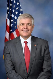
Cliff Bentz (R)
Source: campground records from RIDB, NPS, USFS EDW and BLM, unified by CAMPANAC, refreshed nightly