Spillway (Lake Ouachita)
1Heads up1 fire 50 mi away
- Right now
- Nobody has saidNo season, no closure, no bookings to read
- Sites
- 1All of them booked ahead
The place
the agency’s own description · what’s there · 3 notices
In the agency’s own words
Spillway Recreation area is tucked away in a small cove of Lake Ouachita. The day-use area offers shoreline fishing access, swim beach, restroom, boat ramp, reservable pavilion and access to the Lake Ouachita Vista Trail (LOViT). The LOViT trail is a 40 mile long trail system that meanders along the southern shore of Lake Ouachita. The area is also home to Echo Canyon Resort and Marina. Click here for the Lake Ouachita Virtual Tour. Keep reading
Recreation
Water skiers, jet skiers and anglers can all enjoy the crystal clear waters of the lake, while hikers enjoy the location on the Lake Ouachita Vista Trail (LOViT), which meanders across the south end of the lake.
Natural Features
Lake Ouachita is nestled in the Ouachita Mountains just 10 miles west of Hot Springs National Park. The pool is fed by the cool waters of the Ouachita River and extends about 30 miles over 40,000 surface acres. Contact Info This location is unstaffed. To speak with our main office for general information, please call: (501) 767-2101.
Nearby Attractions
Head to Hot Springs National Park and discover how it earned the nickname, "The American Spa." Or take a scenic drive through the 1.8 million-acres of Ouachita National Forest.
What the agency tells you
Spillway Recreation Area is a designated alcohol free area by court order. No alcohol is allowed in the area
No golfcarts and other off-road vehicles allowed in park.
Don't Move Firewood: Protect your forests from tree-killing pests by buying your firewood locally and burning it on-site. Visit Dontmovefirewood.org for further information.
Tents and rigs
- Sites
- 1
- Hookups
- None
- Accessible sites
- None listed
Around the campground
- On the water
- Hot springs, Lake, River, Beach
- Hiking
- Swimming
- Water access
No reading yet, book on recreation.gov
Every site here is reservable, and the record lists none held back for anyone who drives up.
No availability snapshot inside the last 36 hours, so this page draws nothing rather than ageing a reading into fiction.
Watch for a cancellation
Full? Watch it.
One email when a night opens, plus More Than Just Parks dispatches. Unsubscribe any time.
We read recreation.gov once an hour, at 40 minutes past, and write the first time a site in your window is free for the nights you asked for.
Scanners that check every few minutes exist, and most of them charge. This one is free, it reads the same calendar, and it won’t always be first.
Tell me when the season opens
Watch for the season to open
One email when the season goes on sale, plus More Than Just Parks dispatches. Unsubscribe any time.
We check once an hour, at 40 minutes past, and write the first time the agency has that season on sale.
Scanners that check every few minutes exist, and most of them charge. This one is free, it reads the same calendar, and it won’t always be first.
We make nothing when you book. The link goes straight to the government.
Every line of the receipt · 12
What you actually pay
Who keeps the booking fee
The agency’s own policy text says the reservation fee and the cancellation processing fee are “retained by the reservation service contractor”, and that a campground concessionaire will decline to refund them because “they did not receive these fees”. Recreation.gov is run under contract by Booz Allen Hamilton. What share of your booking fee the contractor keeps isn’t published in any federal dataset we can read, so we print no number for it. Our reporting on the contract →
How we know this receipt · 5
rules read Sep 9, 2026 · rates Oct 1, 2026 · How we know all this
The sites
2 records · the site map
All 2 records
Measured shade is NLCD Tree Canopy Cover 2024 (USDA Forest Service / MRLC) read at the site’s own coordinate, 27% canopy or more, and only for the sites the agency gave no Shade value. It never changes the agency’s own shaded count beside it.
| A | Group Tent Site A | type not stated | 172 ft | ||
| A | PAV 1 | day use | 20 amp | 148 ft | $50 |
The agency files 1 more record here that isn’t a site for the night. It files it as day use. It’s in the table above, marked for what it is, and it isn’t counted as a site.
OpenStreetMap has no toilet mapped within 1 km of this campground, so no site here carries a toilet distance. That’s a gap in the map, not a finding about the campground.
Getting there
the map and the coordinate · the agency’s directions · the phone number
Where it is
 Avery1.3 mi
 Stephens Park1.4 mi
 Brady Mountain3.0 mi
 Crystal Springs (AR)8.2 mi
 Charlton Recreation AreaOuachita National Forest · 10 mi
 Gulpha Gorge CampgroundHot Springs National Park · 11 mi
From Hot Springs, AR: Take US 270 west to AR-227 N/Mountain Pine Rd for 6 miles. Continue straight on Blakely Dam road through Mountain Pine and past Blakely Mouantain Dam. Spillway Reacreation area is at the end of Blakely Dam Road
The weather
the next four days · the thirty-year normal
Next four days, and the thirty-year normal
Forecast
NWS forecast for Mountain Pine, AR
Typical weather
Typical October night 48°F, day 73°F.
Coldest month of the year: typical January night 29°F, below freezing. Bring a bag rated colder than that, and expect ice in the water bottle.
Daily high and lowDays with 0.10 in or more
A normal is the 1991-2020 average for the month, not a forecast: about half of all Augusts are colder than the August line. The seven-day forecast above answers the other question.
The land, and who answers for it
what threatens it · who answers for it
Roadless country, and what’s coming for it
You’re camping on ground somebody wants. We track the threats and the comment deadlines.
Who answers for this land
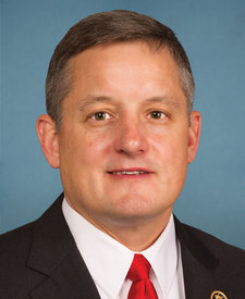
Spillway (Lake Ouachita) is in Arkansas’s 4th congressional district. Its representative, Bruce Westerman (R), votes on the laws that decide what happens to this land. Public-lands grade so far: F. See every public-lands vote →