U.S. Forest Service · National Forest · Utah
Uinta National Forest
Here, 3% take walk-ups.
40Campgrounds
1Take walk-ups
$10–$30.43A night, across 26
1,400Sites, from 34
5,210–9,480 ftElevation
Where they are
40 of 40 mappedDrawing the map
© OpenFreeMap · OpenStreetMap · Esri hillshadeSource: RIDB · NPS · USFS EDW · BLM, unified by CAMPANAC · Oct 23, 2026
The campgrounds
40 campgrounds
 Currant CreekReservablefrom $30.4112 hike-in sites2 pull-through sites82 sitesrigs to 55 ft7,910 ftdrinking watertoilets
 DiamondReservablefrom $27.455 walk-in sites3 hike-in sites72 sitesrigs to 70 ft5,210 ftdrinking watertoilets
 Payson LakesReservablefrom $27.4560 with a tent pad19 pull-through sites90 sitesrigs to 71 ft7,980 ftdrinking watertoilets
 RenegadeReservablefrom $228 pull-through sites63 sitesrigs to 30 ft7,670 ftdrinking watertoilets
 Soldier CreekReservablefrom $2247 pull-through sites1 group site164 sitesrigs to 90 ft7,730 fthookups
 Strawberry BayReservablefrom $22111 pull-through sites7 group sites280 sitesrigs to 104 ft7,640 fthookupsdrinking watertoilets
 Aspen Grove (Uinta-Wasatch-Cache National Forest, UT)Reservablefrom $30.415 pull-through sites58 sitesrigs to 60 ft7,750 fthookupsdrinking watertoilets
 Granite Flat (Utah)Reservablefrom $27.454 hike-in sites56 with a tent pad56 sitesrigs to 74 ft6,640 ftdrinking watertoilets
 Strawberry Bay Long TermReservablefrom $2211 pull-through sites45 sitesrigs to 60 ft7,640 ftdrinking watertoilets
 Little MillReservablefrom $27.4511 hike-in sites40 with a tent pad40 sitesrigs to 65 ft6,050 ftdrinking watertoilets
 Mt. TimpanogosReservablefrom $27.6728 with a tent pad2 pull-through sites39 sitesrigs to 20 ft6,910 ftdrinking watertoilets
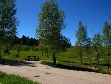 BlackhawkReservable23 group sites38 sitesrigs to 45 ft7,960 ftdrinking watertoilets
 TimpoonekeReservablefrom $27.4534 with a tent pad1 group site34 sitesrigs to 30 ft7,250 ftdrinking watertoilets
 Lodgepole at HeberReservablefrom $30.432 group sites32 sitesrigs to 99 ft7,790 ft
 Ponderosa UintaReservablefrom $25.841 pull-through site32 sitesrigs to 110 ft6,280 fthookupsdrinking watertoilets
 WhitingReservablefrom $27.451 pull-through site2 group sites32 sitesrigs to 45 ft5,450 fttoilets
 Balsam (Uinta-Wasatch-Cache National Forest, UT)Reservablefrom $27.4511 hike-in sites4 pull-through sites29 sitesrigs to 35 ft5,920 fttoilets
 Mill HollowReservablefrom $26.831 hike-in site2 pull-through sites28 sitesrigs to 50 ft8,840 ftdrinking watertoilets
 HopeReservablefrom $27.671 walk-in site23 with a tent pad25 sitesrigs to 35 ft6,630 fttoilets
 CherryReservablefrom $27.454 group sites22 sitesrigs to 48 ft5,340 fttoilets
 Tinney FlatReservablefrom $25.6819 with a tent pad3 group sites22 sitesrigs to 99 ft7,050 ftdrinking watertoilets
 Maple CanyonReservableSeasonalfrom $104 walk-in sites1 group site19 sitesrigs to 30 ft6,910 fttoilets
 Soldier Creek Long TermReservablefrom $225 pull-through sites19 sitesrigs to 50 ft7,730 ftdrinking watertoilets
 Renegade Long TermReservablefrom $221 pull-through site17 sitesrigs to 59 ft7,670 ftdrinking watertoilets
Source: RIDB · NPS · USFS EDW · BLM, unified by CAMPANAC · Oct 23, 2026
This land
measured from the nearest campground in the unitRoadless
Roadless
Roadless
Roadless
Roadless
Roadless
Camping here is a stake in what happens to it. More Than Just Parks tracks the threats and the comment windows.
Source: USFS Inventoried Roadless Areas via MTJP Roadless Map · Jul 29, 2026
Who answers for this land
Uinta National Forest’s campgrounds sit in 2 congressional districts. These members vote on the laws that decide what happens to this land.

Mike Kennedy (R)
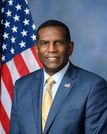
Burgess Owens (R)
Source: campground records from RIDB, NPS, USFS EDW and BLM, unified by CAMPANAC, refreshed nightly